


Contamines Aiguillette des Houches

c.gourme
User
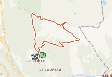

Length
10.6 km

Max alt
2273 m

Uphill gradient
922 m
Km-Effort
23 km

Min alt
1336 m

Downhill gradient
928 m
Boucle
Yes
Creation date :
2022-09-04 06:46:49.0
Updated on :
2022-10-05 16:50:32.819
5h12
Difficulty : Medium

FREE GPS app for hiking
 SityTrail
IGN / Geographical institutes
SityTrail Plus
The world is yours!
About
Trail Walking of 10.6 km to be discovered at Auvergne-Rhône-Alpes, Upper Savoy, Les Houches. This trail is proposed by c.gourme.
Positioning
Country:
France
Region :
Auvergne-Rhône-Alpes
Department/Province :
Upper Savoy
Municipality :
Les Houches
Location:
Unknown
Start:(Dec)
Start:(UTM)
328660 ; 5085960 (32T) N.
Comments